Lake Isabelle and women who live their lives

What I love about this project is the sleuthing (and the hiking, of course).  I love the question:  Who was ___?  I love the beginning search, the simple typing of a name into Google.  With these women's names, it has not yet been easy or straight-forward, not the way it would be if I were researching for and writing a book about Stephen Long (Long's Peak) or Nathan Meeker (Mount Meeker).  Those men have Wikipedia pages, clear book references, whole histories.  Not so with the women.  The naming convention is part of the problem -- with only a first name, Google has difficulty proceeding.  "Who was Isabelle?"  "Who was Helen?" "Who was Molly?" I have to add geographical details, key words:  "Who was Rosalie, Mount Evans area, Colorado history?"  I have to hope I will crack the mystery.

As my wife, our daughter, and my wife's mother Elaine drove from Evergreen to hike to Lake Isabelle last Friday, I learned that the lake (and the glacier remnant that feeds it) was named by Boulder County engineer Fred A. Fair, to honor his wife. However, though I crouched in the backseat of the car and searched on Google until the curvy roads made me sick, I could find nothing else.  No record of Isabelle Fair.  No indication of where she was from, who she was, or when she died.  I found quite a bit of information about Fred, who had discovered both the Isabelle Glacier and the Fair Glacier in 1908, but none of the sites that detailed his biography mentioned anything about Isabelle.  "It looks like Fred married two other women after Isabelle," I called to the front seat.

A Wikipedia Commons photo, taken by Junius Henderson in 1910, of Isabelle Glacier

My mother-in-law nodded.  "She probably died in childbirth.  Women so often did."

And so, as we set out from the Brainard Lake Trailhead, I started to brainstorm a blog post about women's fragile lives, about medical advances, maybe about child-bearing.  I gazed at Lake Isabelle and wondered if Fred had lingered on its shore and mourned his wife Isabelle.  I know about grief.  I would add some of those thoughts to my blog post.

Meredith and Mitike on the Jean Lunning Trail, on the way up to Lake Isabelle
But I am never content to guess.  When we returned, happy, from our hike through glorious wildflowers to the stunningly beautiful Lake Isabelle, I tried Google again.  Nothing.  It was as if Isabelle Fair had entirely disappeared.

Finally Meredith, who had been watching my frustrated search from the other side of our bed, suggested I try Ancestry.com.  Lately, I've been interested in building my family tree (and Meredith's) on that website, but I hadn't yet thought of it as a research tool for other purposes.  I kissed her and then created a new tree entitled "Isabelle Fair," and began.

Ancestry.com is a little bit magical.  It pulls from birth records, census records, military records, marriage records, and death records to help people build their family trees.  I merely pretended I was Isabelle, added my spouse Fred A. Fair, and waited for the Ancestry.com green leaf, which indicates "hints" about connections to that person.  And the mystery of Isabelle began to unfurl.

The first document Ancestry.com found was a U.S. Census record from Boulder in 1920.  In that year, ten years after University of Colorado Museum of Natural History professor Junius Henderson named Isabelle Glacier and Fair Glacier in Fred Fair's honor, Fred lived with his wife "Isabell" and two roomers, a Leo and Helen Golden.  No children.


Because I loved the romantic vision of Fred mourning on the edge of Lake Isabelle, I thought maybe Isabelle had died just after that.  I found birth records for Fred Adam Fair (1926), John Henry Fair (1927) and Marion Jay Fair (1930), and noted that all three were the children of Fred and a woman named Mary Jane Burger, who died in 1932.  I found a 1932 marriage record to Ruby Goodwin.

And then I found a death record of a Leo Francis Golden, who was born on April 27, 1921.  I assumed his parents were Helen and Leo Golden, the roomers who lived with the Fairs -- until I learned (more Census records) that Helen was Leo's sister.

Finally, a 1930 Census record solved the mystery.  In 1930, 8-year-old Leo lived with his parents in Los Angeles, California.  His parents were Leo Elbert Golden, age 46, and Isabel Golden, age 46.


Sometime between the 1920 Census and the 1930 Census, Isabel (Isabelle?  Isabell?) had divorced Fred, given birth to Leo F., married Leo E., and moved to California (it's not clear what order she did all of that, as I can't find her marriage record to Leo or her divorce record from Fred).

She did not die.  In fact, she lived a long life in California, maybe happily, until the age of 83.  Her son Leo Francis lived until the age of 92, dying in Sitka, Alaska, in 2014 (interestingly, I worked in Sitka in 2001 and visited often after that, and may have crossed paths at some point with Leo).

The family tree Ancestry.com built for Isabel (Frances Isabel Womack)
The story of the Isabelle of Lake Isabelle and Isabelle Glacier is not one of death in childbirth, but one of a woman who married young (in Missouri, at age 20), moved to Colorado with her engineer husband, and fell in love with another man.  It's the story of a woman who lived her life bravely, though her world must have frowned upon her boldness.

Fred may have brooded on the edge of Lake Isabelle, but out of anger or despair at his wife's departure, not at her death.  Did they have children together?  I can't find any evidence that they did, though they were married 18 years.  That might explain Isabel's attraction to the new engineer, Leo.

What I do know: Professor Junius Henderson did not know how to spell "Isabel" when he marked the name on a lake and a glacier.

What I also know:  I want to be a woman who lives my life as fully as I can, like I think Isabel did.

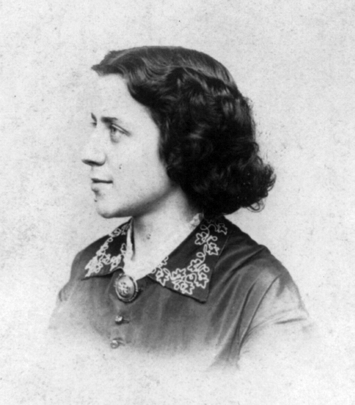
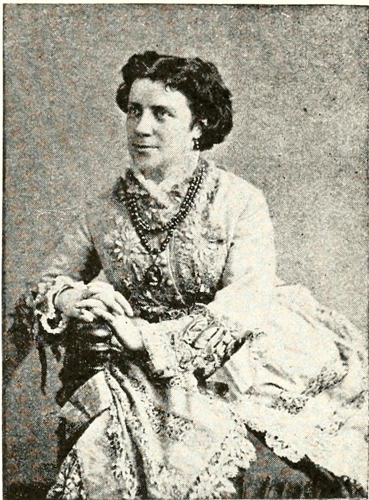
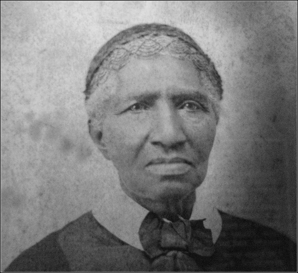
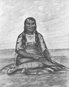
Four women working to live their lives as bravely and boldly as possible.

How to hike to Lake Isabelle and Isabelle Glacier:

1.  Drive to the Brainard Lake Recreation Area, which requires a National Parks pass or the $11 day-use fee to enter.  Note:  even on a week-day in the summer, visitors who arrive later than 9 am will need to park in the day-use lot at Brainard Lake instead of at the Long Lake or Niwot Trailheads, which adds an extra mile round-trip to the hike.

2.  Hike either the Niwot Cut-off Trail from the Niwot parking area or the Long Lake Trail from the Long Lake Trailhead.  At the southern edge of Long Lake, you have a choice to hike the trail on the east shore or the Jean Lunning trail on the west shore -- in July, the flowers and the views on the Jean Lunning trail are magnificent.

3.  At the end of Long Lake, take the Pawnee Pass Trail to Lake Isabelle.  The trail zigzags steeply up to a shelf just before the lake, but the climb is well-worthwhile.  People who want the expansive views hike all the way up to Pawnee Pass.

4.  From the lake, the trail continues up to the remnant of Isabelle Glacier.


The trail along Lake Isabelle toward the glacier.

Sources:

Cockerell, T.D.A.  "Junius Henderson." The Nautilus.  51 (3):  97-99.  Retrieved from https://archive.org/stream/nautilus51amer#page/96/mode/2up.  Web.  24 July 2017.

"Fair Family."  Rootsweb.ancestry.com.  22 January 2016.  Retrieved from http://wc.rootsweb.ancestry.com/cgi-bin/igm.cgi?op=GET&db=press&id=I613.  24 July 2017.  Web.

"Glaciers of Colorado."  Portland State University, 2009.  Retrieved from http://glaciers.research.pdx.edu/Glaciers-Colorado.  24 July 2017.  Web.

"Isabel Frances Womack Golden."  Findagrave.com.  Retrieved from https://www.findagrave.com/cgi-bin/fg.cgi/page/gr/%3Cbr%3E..http://www.findagrave.com/cgi-bin/fg.cgi?page=gr&GRid=177467606.  24 July 2017.  Web.

"Leo F. Golden."  www.tributes.com.  Retrieved from http://www.tributes.com/obituary/show/Leo-F.-Golden-99393224.  24 July 2017.  Web.

"Womack, Frances Isabel." Ancestry.com.  22 July 2017.  Web.

Bluebells and Lake Isabelle (July 2017)


Lady Moon, and being "good enough"

My sister Katie and I are women who worry, constantly, about how to be good enough.  At 37 and 40, we are both women with graduate degrees, lovely Colorado houses, children, and loving spouses -- and yet we both become easily consumed by anxiety that we are not good enough wives, good enough mothers, good enough friends, good enough daughters, good enough artists, good enough people.  Our worry weighs on us, threatening us, unbalancing us.

We talked about this as we hiked the Lady Moon Trail near Red Feather Lakes last week.  What has made us this way, when other people evidently waltz through their lives with very little worry at all?  Why do we feel so responsible for everything and everyone?  Was it our upbringing on an Iowa farm, in a culture that praised children primarily for their contributions and hard work?  Was it the model of our mother and our aunts, our grandmothers and our great-grandmothers, who hurried to please and do and fix?  Or did we simply inherit a chemical propensity to be anxious?

And how can we teach our daughters, Elida and Mitike, to relax into who they are, to live fully in the moment, to take responsibility for only what is theirs?  Even more importantly, how can we unlearn all this worry and model more confidence for them?

The Lady Moon Trail to Molly Lake (July 20, 2017)

We talked about Chimamanda Adichie's 2016 book, Dear Ijeawele, or A Feminist Manifesto in Fifteen Suggestions, in which Adichie advises women to teach their daughters to be kind, not "nice."  We talked about a parenting book Katie had just read that warns against only praising children for what makes the adults proud, lest they learn that they are only loved when they please us.  We talked about our childhood on that farm in eastern Iowa, which always felt idyllic, with its barefoot summers in the long cool grass, and which maybe was.  We talked about Elida and Mitike, about what we love about the strong little women they are becoming, and about how we worry about them.

Meanwhile, the Lady Moon Trail wound its way through stands of aspens on an old road overgrown with yellow Golden Banner, blue Harebell, and deep pink Horsemint.  And the longer we walked, the better it was to just hike together in the sunshine, to photograph some Wyoming Paintbrush, to strike silly poses with a moose antler, to watch the clouds build over the Mummy Range.

The Lady Moon Trail winds through purple Horsemint here (July 2017).

By the time we reached Molly Lake (a lake named for a Molly I cannot find in any histories of the area), we had laughed quite a bit, too, and that tension we each hold too much of our lives had eased.  We agreed that we can (and do) teach Elida and Mitike this.  Get outside yourself, literally.  Walk for miles with a beloved person who knows you well.  It becomes easier and easier to just be, to forget the anxiety about what we should do.

My sister Katie being wonderfully silly with a moose antler (July 2017)
*

Unfortunately, that awareness (for me, and I think for Katie) only lasts a moment.  As I drove south back to Denver, I fell quickly into ticking through all the "shoulds":  I should get groceries, I should take Mitike to more museums, I should be a better communicator with my far-flung friends, I should start planning my lessons for the next school year, I should work more on that novel, I should be a better house cleaner, I should. . . The "shoulds" overwhelm.  They threaten to choke me.

Then I started to think about Lady Moon, for whom the trail Katie and I hiked (and the inaccessible private lake that trail parallels) was named.

Catherine Gratton Lawder Moon did not worry, ever, about being good enough.

When, orphaned after her Irish parents' deaths in St. Louis, she worked for a physician as a servant, she did not try to speak properly, but earned the nickname "Cussing Kate."

When she turned 18 in 1883 and struck out for the West, finding work as a laundress, maid and waitress at Norman's Elkhorn Lodge in Larimer County, Colorado, she did not try to preserve a reputation, but earned money from male visitors in whatever ways she could.

When Cecil Moon, a son of an English baron, fell sick and needed nursing on the ranch she and her new husband, Frank Garman, ran, she did not worry about what was morally right or socially permissible.  She fell in love with Cecil, divorced Frank, and became "Lady" Moon.

When Cecil pleaded with her to don dresses, speak quietly, and behave demurely at his family's estate in England when they visited in 1889, she refused.  She wore her cowgirl clothes, rode Western style on her horse Moses (whom she had brought to England on the ship from America), and flouted her Irishness in Cecil's parents' faces.

When the Larimer County authorities accused Catherine of burning down her own house on the Moon ranch above the Elkhorn to collect the insurance money, she shrugged, continuing to ride into Fort Collins clad in the fine clothes, furs, and jewelry she had supposedly lost to the fire.

Catherine Grattan Lawder "Cussing Kate" Moon
In 1909, when Cecil filed for divorce so he could claim his title and wealth from his family, who refused to accept Catherine, Lady Moon did not fall to his feet weeping; she did not beg him to stay.  She laughed in his face, because he had signed over all of his properties and wealth to her on his many drunken nights.  She became the first woman west of the Mississippi to pay a man alimony.

When the U.S. government outlawed alcohol in the Prohibition Act of 1920, Catherine brazenly distilled her own bootleg whiskey on her ranch, which she and her men then sold in Fort Collins.  She sewed a special lining into her bloomers to hide her stash.  One night at a party on her ranch, she fell down drunk and glass bottles of whiskey clattered out.  She was arrested, but then acquitted because no authority was willing to search her bloomers.

She ran her ranch like a man.  She held raucous parties; she kept over twenty dogs at a time; she swore and caroused with her ranch hands and various boyfriends.

Harebell and Golden Banner on the old Lady Moon Ranch.

Again and again, the cattle ranchers in Red Feather Lakes and Livermore pleaded with Lady Moon to close and chain the cattle gates after she rode her horse, Lady West, through them, but she shrugged off their pleas.  It took the ranchers weeks to separate their own cattle from the mixed-up herds.  (In stark contrast, my sister and I dutifully re-latched each of the three cattle gates through which we passed on our hike.)

Two women who always latch cattle gates.

In 1925, at age 61, she did not even die politely.  Some say she died of uterine cancer; some say she died of alcohol poisoning, and some say she was the woman found murdered in the Livermore Hotel, maybe by her own bootleggers.  It's true that her will revealed a good heart:  she left the bulk of her remaining money ($500) to the St. Vincent's Orphanage in Denver.  But she lived hard, and always against what society thought she should be.

Lady Moon's gravestone in Fort Collins, CO
Her refusal to obey convention -- to obey anyone, actually -- made Lady Moon famous.  Her life inspired a Broadway play, Sunday; the radio soap opera, Our Gal Sunday; a one-act play, Lady Moon; a novel, The Lady from Colorado; and an opera, The Lady from Colorado (revised as Lady Katie).

Wow.

But. . .do my sister Katie and I want our daughters to be like that?  NO.

Do we want Elida and Mitike -- and ourselves -- to gain a little more of that I-could-care-less fire?  Yes.  I'm certain Lady Moon never lay down in her bed at her ranch worrying about whether she had done enough that day, or whether she had offended anyone.  She did not care.  She believed, deeply, that she was good enough exactly as she was.

And maybe that's why I want to research all these women Colorado has honored on the maps.  I want to learn other ways to be a woman.  I want to whisper those ways into Mitike's and Elida's ears; I want to tell those stories to myself and to my sister.  I want us all to know that sometimes, it might be important to hide whiskey pints in our bloomers and swear with the men.

And sometimes, it might be okay to leave the cattle gate unlatched.  Maybe.

*

A Red Dome Blanket Flower in the aspens on the Lady Moon Trail (July 2017)

How to hike the Lady Moon Trail to Molly Lake
1. Drive to the Lady Moon Trailhead, just south of Highway 74E (across the road from the Mount Margaret trailhead).  Note:  Lady Moon Lake is on private property, so it is not possible to hike there (thus the hike to Molly Lake -- I've emailed the Red Feather Historical Society hoping they can give me insight into who Molly was).  I DO appreciate that, like Lady Moon herself, Lady Moon Lake defies societal rules, but it's not worth the fine/trouble of striking out across private ranch land to get there.

2.  Hike about 1.1 miles from the trailhead to the junction with the Granite Ridge Trail, and turn right toward Manhatten Road (it's clearly marked with a sign).  In July, the wildflowers on this route were stunning.  Note the Horsemint, the Mariposa Lily, the Golden Banner, and the several varieties of paintbrush.

3.  Hike for 2.7 miles (through two cattle gates) to a clearly marked junction with the Molly Lake trail.  A very short trail leads to the placid Molly Lake, which is surrounded by lovely smooth stones perfect for lunch spots.  We saw quite a bit of evidence of moose -- scat, an abandoned antler, and hoof prints in the mud -- but we never saw the moose himself.  

4. Return the way you came, or get someone to pick you up at the Molly Lake Trailhead, just under a mile from Molly Lake.  No matter what, enjoy the solitude.  In our 7.6-mile hike, Katie and I saw only three people (all at Molly Lake).

Who was Molly?  I haven't figured that out yet, but Molly Lake is a peaceful place (July 2017).


*


Sources:
"Catherine Lawder -- Fort Collins' 'Lady' Moon."  Fort Collins Historical Society.  Retrieved from https://sites.google.com/site/fchistoricalsociety/ladymoon.  22 July 2017.  Web.

Fleming, Barbara.  "Lady Moon left riches-to-rags story in Fort Collins."  19 September 2015.  The Coloradoan.  Retrieved from http://www.coloradoan.com/story/news/2015/09/20/lady-moon-left-riches-rags-story-fort-collins/72418632/.  22 July 2017.  Web.

"Lady Moon."  Retrieved from http://operapronto.info/mementos/exh_moon/exh_moon.html.  22 July 2017.  Web.

"Lady Moon Ranch Tour."  Retrieved from http://redfeatherhistoricalsociety.org/tours-events/historical-site-tours/lady-moon-ranch-tour/.  22 July 2017.  Web.

Livermore Woman's Club History Committee.  Among These Hills:  a History of Livermore, Colorado.  Double DJ Enterprises, 1995.  Print.

Looney, Robert C.  "The Story of Fox Acres."  October 1978.  Retrieved from http://www.foxacrescommunity.com/picture/looneyfoxacres_part1.pdf.  22 July 2017.  Web.

"West of Lady Moon."  Groundspeak, Inc.  Retrieved from https://www.geocaching.com/geocache/GC4CJJ6_west-of-lady-moon?guid=029898d3-ec5c-4628-850f-3a73bb3fb3b4 .  22 July 2017.  Web.

"Wrangler Trail Stories." Retrieved from http://www.sundancetrail.com/staff/dude-ranch-jobs-staff-orientation-articles/wrangler-trail-stories/.  22 July 2017.  Web.


Update on re-naming Squaw Mountain

After readers of this blog submitted their "votes" for the re-naming of Squaw Mountain, I decided Mistanta/Owl Woman had the most support, since she is a notable Native American woman who worked to bridge differences in one of Colorado's first and most important trading forts (before the era of expulsion and massacre).  I have just submitted a proposal to the US Board on Geographic Names to change Squaw Mountain in Clear Creek County (I guess I'll work on Routt County's Squaw Mountain and Teller County's Squaw Mountain later) to Mount Mistanta.  Wish the proposal luck!


On Squaw Mountain -- and renaming it

Although it is not named for a specific woman, I have to discuss Squaw Mountain, which is an 11,773-foot mountain near Idaho Springs, and which I love for its surprisingly astounding view and for the little fire lookout tower on its summit.  I love it, but its name twists my heart every time I hear it.

Squaw Mountain is the perfect triangle on the left -- viewed from my mother-in-law's house in Evergreen, CO.

The origin and the appropriateness of the word "squaw," according to an article from Indian Country Today, has been much debated.  Some historians (including Dr. Marge Bruchac, an Abenaki historical consultant) argue that, in the Algonquin languages, the word merely means "woman" or "wife".  However, others have argued that the English word came from a French corruption of the Mohawk (or Iroquois) term for "vagina," which gives sexual meaning to the word. Suzan Shown Harjo, a Cheyenne and Hodulgee Muscogee American Indian rights activist insisted on the Oprah Winfrey Show in 1992 that squaw was certainly an Algonquin word meaning vagina, that it was the equivalent of the "s-word," and that continuing to use it only reinforced a shameful cultural heritage of sexual abuse of Native American women (a reality that continues in today's America, where 1 in 3 Native American women will be raped in their lifetimes).  Harjo's adamant stance inspired many campaigns to rename places in the U.S. that had been named "squaw."  In fact, in the first four months of 2008, the U.S. Board on Geographic Names omitted the name "squaw" from sixteen valleys, creeks, and other sites.  Most notably, the USBGN renamed Arizona's 2,612-foot Squaw Peak Piestewa Peak, to honor Lori Piestewa, a Hopi/Hispanic soldier from Arizona who was killed in Iraq in 2003.

And yet, Colorado still has a Squaw Mountain in Clear Creek County.  Worse:  Colorado has a Squaw Pass in Clear Creek County, a Squaw Pass in Hinsdale County, a Squaw Creek, a Squaw Gulch, a Squaw Point, a Squaw Canyon, and two other Squaw Mountains (one in Routt County and one in Teller County).

If Harjo and others are correct, we have Slut Mountain, Slut Pass, Slut Creek, Slut Gulch, Slut Canyon.  The ugliness of the word -- of its import -- becomes clear.

If Harjo and others are correct, we have places named not to honor the Ute, Cheyenne and Arapaho women who walked in these woods and camped in these meadows and canyons, but places named to "honor" the dishonorable and violent ways in which those women were regarded and used.

If Harjo and others are correct, we have places named to commemorate massacres like Sand Creek, in which over 400 women, children, elders and disabled Cheyenne and Arapaho people were raped, murdered, and mutilated.

If Harjo and others are correct -- and I believe they are -- we must rename all the places that still retain "squaw."  We must choose names that allow us to tell our children honorable, not horrific, stories.

My wife's cousin Amber asked in a comment on my last post how we can convince the powers that be to rename the places we love, to honor the good and not the shameful.  I did some research on this, and I found an answer in number 6 on the the FAQs on the U.S. Board on Geographic Names site.  The proposed change of name must be for a "compelling reason," and the name must be for someone who has been dead at least five years.  A "compelling reason" includes changing a "derogatory name".  I do not think I will have much luck proposing a change to Mt. Evans' name, but I do think I could successfully propose a change to Clear Creek County's Squaw Mountain.  What name should I propose?  Please vote in the comments section, and explain why you think that name should be the one I propose to the USBGN (note:  I did not mention the Ute Chipeta here, since she already has Mount Chipeta named for her -- more on that someday).

1.  Mochi (1840-1881), the 24-year-old Southern Cheyenne survivor of the Sand Creek Massacre who became a warrior to avenge her people (see my post on Mount Rosalie).  She participated in several raids -- the most notorious of which was the attack on the German family on a stagecoach route in Kansas.  Shortly after, Mochi, her husband Medicine Water, and 33 others were caught and incarcerated as prisoners of war of the U.S. (Mochi is the only Native American woman to ever be held as a POW in the U.S.).
2.  Mistanta (Owl Woman) (1800-1847), the wife of William Bent, who ran Bent's Fort in eastern Colorado.  Owl Woman was a Southern Cheyenne leader who helped negotiate trade between the many groups who traded at Bent's Fort, and helped maintain good relations between the white people and the Native people.  As the eldest daughter of the powerful Cheyenne leader White Thunder, Mistanta worked as a translator and important bridge between the indigenous tribes and the newcomers, in an era before the military-ordered massacres and removals.
3.  Helen White Peterson (1915-2000), who was part Cheyenne and part Lakota Sioux, and who moved from Denver to Washington, D.C., in 1953 to become the first Native American woman director of the National Congress of American Indians, and later returned to Colorado to start an ethnic studies program at Colorado College.
4.  Dr. Susette "Bright Eyes" La Flesche (1854-1903), who was of the Omaha tribe (the daughter of an Omaha chief), attended a Historically Black College (Hampton), earned her medical degree, and returned to practice medicine on the reservation, working to improve the situation of Native Americans.  Again, no direction connection to Colorado, but a Native American woman to be honored.
5.  Sarah Winnemuca (c. 1844-1891), a Northern Paiute activist and writer, who traveled across the United States (certainly through Colorado, and definitely to D.C.) speaking about the rights of Native Americans.
A watercolor/sketch of Mistanta/Owl Woman done at Bent's Fort by Lt. James Abert in 1845.  Squaw Mountain could easily be re-named Mount Mistanta or Mount Owl Woman, to better honor a specific Colorado Native American woman.

We can better name the lovely pyramid between Evergreen and Idaho Springs.  It's true that a re-naming will also require a re-naming of the pass, of the fire lookout, and of the road -- and maybe of the neighboring Chief Mountain -- but a beginning seems important.  Which Native American woman should we honor?

The sign near the top of Squaw Mountain, May 2016 (note the fire lookout at the summit, just barely visible in the fog)


*

How (and why) to hike this mountain (4.1 miles RT):
1.  Drive on Squaw Pass Road (also called Highway 103) west from Evergreen (or east from Echo Lake) to a clearly signed place to the south of the road.  4WD vehicles can drive up another 0.7 miles to a gate, but only in the summer.  In the winter after a heavy snow, the road/trail is barely passable for people wearing snowshoes.

2.  Hike past the gate up the wide road, following clear signs to Squaw Mountain.  Toward the top (about two miles from the parking area on the road), the trail/road begins to zigzag up to the fire lookout tower, which is available to rent overnight -- click HERE for the reservation site.  It's very popular; reserve months in advance.

3.  The summit of Squaw Mountain affords lovely views of Mount Evans and Rosalie and of Pikes Peak to the south.  It's a beautiful place to sit for awhile -- even better, it's a perfect place to spend the night.  Although my wife and I saw only snow and fog from the 360-degree windows in the fire lookout, we loved the silence of the deep snow (and noted that many others had written about a howling, threatening wind in the cabin log).

4.  How much better would it be if we could say we had spent the night in the fire lookout on the summit of Mount Mochi, or Mount Mistanta, or Helen White Peterson Peak?  Remember to "vote" for your favorite re-naming option of Squaw Mountain -- just leave a comment.
My wife on snowshoes in front of the fire lookout on Squaw Mountain (May 2016)

Our "view" from the fire lookout, May 2016


Mount Rosalie and Rosalie Bierstadt

I love to look at Mount Rosalie.  From my sister-in-law's deck in Pine, Colorado, it's a pleasingly rounded summit, a dome blanketed in snow until late in the summer.  Beside its 13,575-foot gentle rise, Mount Evans and Mount Bierstadt, both 14ers, appear harsh, craggy, forbidding.  And yet Rosalie is deceptive.  It is easy to summit Mount Rosalie from the Mount Evans road -- merely drive up the zigzagging road to just above Summit Lake, park, and hike south up and over Epaulet Mountain and then to Rosalie.  But I'm not sure this counts as "climbing" Rosalie any more than parking at the lot on Evans and walking the final half mile to its summit counts as climbing that 14er.

The dome of Mount Rosalie from the Hwy 285 junction in Pine, CO

To climb Mount Rosalie, and say you've really done it, you must begin at the bottom -- and you must know the history of the person for whom the mountain is named -- and the controversy that surrounds it still.

Who was Rosalie?

In 1863, when the painter Albert Bierstadt climbed the mountains known today as Evans and Bierstadt, Rosalie was not yet his wife.  In fact, Rosalie was the wife of Bierstadt's friend, the American author and journalist Fitz Hugh Ludlow, whom Bierstadt had invited to accompany him on the trip west.  Bierstadt did not even know Rosalie except from Ludlow's detailed descriptions.  However, in just three years -- after mutual accusations of infidelity -- Rosalie and Ludlow would divorce and she would marry Bierstadt.  Bierstadt's brazen honoring of her on the maps three years before, in the company of her husband, might lead us to wonder if their romance had already begun, at least in his artist's mind.

For me, this dramatic scandal helps interpret Bierstadt's "A Storm in the Rocky Mountains, Mt. Rosalie," which he painted from sketches he did on that 1863 hike.  I've always been a bit perplexed by Bierstadt's paintings, because, though I appreciate the light and grandeur and the clouds in them, they never represent the Rockies as they actually look, depicting them as far more jagged, more Eden-like.  But if this painting is meant to convey Bierstadt's tumultuous love for his friend's wife, then it makes more sense.

"A Storm in the Rocky Mountains, Mt. Rosalie," 1866, Albert Bierstadt (Brooklyn Museum -- https://www.brooklynmuseum.org/opencollection/objects/1558/)
Rosalie was lovely, people said.  Rosalie was a flirt, people said.  Rosalie was popular and rich, people said.  That she divorced a prominent journalist and art critic for a prominent painter seemed to only increase her celebrity status.  In England, she and Albert met Queen Victoria; in Canada, they were the honored guests of a costume ball; in their winter home in Nassau and in their homes on the Hudson and in New York, they were regarded as American royalty.

Rosalie Osborn Bierstadt
However, Rosalie was not a strong woman.  Diagnosed with tuberculosis in 1876, she became increasingly frail and died in Nassau in 1893, at the age of 52.  Her husband Albert Bierstadt would live only another nine years, to die at age 73.


Why is the mountain named Rosalie?

Rosalie the woman was nothing like the gentle dome that is currently named for her.  This is particularly interesting when one realizes that the original Mount Rosalie -- in fact, the Mount Rosalie in Bierstadt's 1866 painting -- was what we call Mount Evans today.  It's true:  for three decades, Colorado had a 14er named after a woman.  However, in 1895, the Colorado legislature changed the name of that peak to Evans to honor John Evans, who had been governor of Colorado from 1862-1865 and who had collaborated with the U.S. military's Colonel John Chivington to carry out the horrific November 29, 1864, Sand Creek Massacre against the Cheyenne and Arapaho.  Too many places honor this despicable man on maps:  Evanston, Illinois; Evanston, Wyoming; Evans, Colorado; Mount Evans (and Colorado's highest peak, Mount Elbert, honors Evans' son-in-law).

In 1865, the Colorado legislature assured everyone that Rosalie Bierstadt would still be honored:  the unnamed 13er near Bierstadt and Evans would be named Mount Rosalie.  However, a campaign continues to restore Rosalie's name to its original peak, to honor an artist's wife and not an architect of genocide.

I thought about all of this as I climbed the five miles from Deer Creek Campground to the summit of Rosalie last summer.  From the saddle between Rosalie and Pegmatite Points, as I trudged west up Rosalie's sloping tundra side, I watched Mount Evans, the cars flashing on the road that winds up its side, and I thought about how shameful it is to give a beautiful mountain the name of a murderer. Privately, I re-named the peak known as Mount Evans Mount Mochi, after the 24-year-old Southern Cheyenne woman who became an avenging warrior after she survived the Sand Creek Massacre Evans had ordered.  We should honor people like Mochi with our mountains' names.

Mochi, a Southern Cheyenne woman warrior, for whom Mt. Evans SHOULD be named
In fact, I think we would do far better to honor women like Mochi than women like Rosalie Bierstadt, whose fame stemmed from the wealth into which she was born and the men she happened to marry, not anything she accomplished or endured.


How to climb the mountain currently named Mount Rosalie:
1. Drive 4.4 miles southwest of Pine Junction on US-285 (toward Bailey), and take a right at the gas station.  This is Deer Creek Road.  Drive 8.3 miles (note the lovely views of Rosalie as you drive) past the Deer Creek Campground and park at the road's end (and note, with the bafflement that I felt) that some people pitch their tents in gravel parking lots when there are ample beautiful sites in the woods along the creek.  Start hiking on the Tanglewood Trail.

2.  After about a mile, you'll reach the junction with the Rosalie Trail.  It feels counterintuitive, but stay on the Tanglewood Trail (the righthand fork).

3.  The trail switchbacks up through a lovely meadow and forest, and then through bristlecone pines to the tundra.  About 3.25 miles from the trailhead, you reach the broad saddle between Rosalie and Pegmatite Points.  The view here is lovely (I shared it with a pair of curious young deer with velvety antlers), and the Tanglewood Trail ambles invitingly onward into the Evans Wilderness.  However, to hike Rosalie, leave the trail and hike west (to your left) toward Rosalie's summit.

Looking back down the east ridge of Mount Rosalie (August 2016)

4.  The dome look of Rosalie translates to many false summits.  Enjoy the views and the soft tundra, and examine the flowers as you catch your breath.  The summit is up there.

An alpine succulent in Rosalie's tundra slope

5.  From the top of Rosalie, the view is stunning, and the flat rocks are a perfect place to recline awhile in the silence and the solitude.  In the hours I hiked Rosalie, I met only two other hikers.  Compare that to the hundreds of hikers on Bierstadt and Evans each day.

From the summit of Mount Rosalie (August 2016)


Sources:

"At home in the huddle:  Watertown, New York."  Retrieved from http://athomeinthehuddle2013.blogspot.com/2013/03/its-garbage-day.html.  Web. 13 July 2017.

Enss, Chris.  Mochi's War.  TwoDot, 2015.

"Mount Evans."  Retrieved from https://en.wikipedia.org/wiki/Mount_Evans.  Web.  13 July 2017.

O'Neill, Tam.  "Albert Bierstadt, Great Art, True Love!" Retrieved from http://www.tamoneillfinearts.com/albert-bierstadt-mt-rosalie/.  Web.  13 July 2017.


Mount Lady Washington and Miss Anna Dickinson

By now, I know Anna Elizabeth Dickinson so well it's as if I knew her personally.  Before the summer of 2013, I had never heard of her (have you ever heard of her?), and yet in the prime of her career, in the 1860s and 70s, Dickinson's name was a household name in America.

Anna E. Dickinson, sometime in the early 1860s
People flocked by the thousands to hear her speak.  She was the first woman to speak on the floor of the U.S. House of Representatives, in 1863. By 1865, she earned $20,000 (the equivalent of about $280,000 today) per year from speaking fees, first as an abolitionist and then as an advocate for laborer's rights, for equality for all, and for women's rights.  Affectionately called "America's Joan of Arc," Dickinson was far more famous than her contemporary, Susan B. Anthony.  She was a celebrity.  Although several wealthy, high-profile men proposed to her, she never married; her letters reveal that she immersed herself in passionate love affairs with women in various cities (sometimes a few women at the same time, and for some months, Susan B. herself). She once wrote to her lover Olive Logan, “Someday, some of us will become so overcome with passion that we will become men, and we will make furious love to our beloved women, and then we shall be married, and live happy forever more.” She played Hamlet on Broadway, and she spoke boldly to anyone who would listen, preferring great rapt crowds.

Anna E. Dickinson, probably in the late 1870s or 1880s (when she exchanged her sombre Quaker dress for fancier clothing)

Anna E. Dickinson, small Quaker woman born in 1842, was astonishing.

But how did the 13,281-foot peak to the northeast of the Long's Peak summit (Rocky Mountain National Park's highest, at 14,259 feet, and one of Colorado's most challenging non-technical hikes) come to be named for Anna Dickinson?  And why did the mapmakers on the 1873 Hayden Survey call the peak "Lady Washington," Dickinson's nickname in mountaineering circles because she had climbed New Hampshire's Mount Washington at least 28 times, and not "Mount Anna"?  Why did they, in fact, name two peaks for Miss Dickinson -- Mount Lady Washington and Mount Dickinson, a remote 11,814-foot summit in the Mummy Range to the northeast?  Did Miss Dickinson, notoriously outspoken and hyper-aware of her public persona, push the Hayden surveyors one way or the other?


In this evening view of Long's Peak from the Moraine Park Campground (taken July 5, 2017), the twin-humped mountain to the left (west) of "The Beaver" rock formation is Mount Lady Washington (13,281 ft).  The triangular 13er to the east of Long's Peak is Storm Peak which is another straight-forward climb from the Boulderfield.

Dickinson was radiant on her tour of Colorado's summits: she rode to see the sunrise on Gray's and Torreys; she pushed boulders off the top of Elbert (a popular pastime for 19th century mountaineers); she raced to the summit of Long's in pants she had made her brother John purchase in Longmont (to the chagrin of the local newspaper); she rode happily to the top of Pikes after an invigorating ride on the cattleguard of the train from Denver.  However, though she was only 31, her journey to the Colorado Rockies in 1873 marked the pinnacle of Dickinson's life.  Shortly after that, her popularity and fame declined as the speaking circuit declined, and then her mental health declined strangely (maybe as a result of alcohol-induced psychosis, maybe because of depression, or maybe her sister Susan wanted her out of the way and so institutionalized her).  After a few months in a mental institution in Pennsylvania in 1891, Dickinson disappeared from the public eye, living in relative anonymity with friends for the last four decades of her life.

Why?  What happened?  For the past four years, since I discovered Anna Dickinson in my work on an essay about my climb up Long's Peak, I have been working to fictionalize her story (last summer, I rented a cabin in Allenspark for a week and made myself write 5,000 words a day), but it doesn't quite work -- not yet.  I'm missing something, even after all my research, even after creating a 95,000-word manuscript.  I haven't found out what I need to about the elusive Anna yet.  But.  Look for that book someday, too.

I can't tell you all the secrets to AED yet, but I can tell you how to hike Mount Lady Washington.  It's straight-forward and well worth it.

The route up Mount Lady Washington diverges from the Long's Peak trail on the northern edge of the Boulderfield, up to the left (that's Lady Washington rising in the lefthand corner).  There is no trail up to the summit of Mount Lady Washington; it's a steep and obvious scramble up boulders to the top. (My photo, July 12, 2016).


How (and why) to climb Mount Lady Washington:
1. Start at the Long's Peak Trailhead (the Long's Peak Ranger Station).  You don't have to leave at 2 or 3 am with the Long's Peak hikers, but I did (habit, I guess), which meant I summited Mount Lady Washington at about 6:30 am and still had ample, relaxed, pre-thunderstorm time to hike over and up to Chasm Lake, too.  I loved hiking down past baffled Long's Peak hikers at about 8 am, too, who all asked, "Did you already summit?"  My answer (true):  "Yes!"

2.  Follow the Long's Peak trail through Goblin's forest, past tree-line, and right at the junction with the Chasm Lake spur trail.  (Note:  some people do choose to climb Mount Lady Washington's east slope from here, but that seems like needless effort and danger to me.  I recommend continuing toward the gentler north slope.)  From that intersection, the Long's Peak trail curves for 1.1 miles along the northeast slope of Mount Lady Washington, providing a good opportunity to admire the mountain on its own (it obscures Long's for much of that time, anyway).  At Granite Pass, the Long's Peak trail climbs in switchbacks toward the Boulderfield.  You'll have to pause to catch your breath often here; admire the red-orange light of the rising sun on the Diamond Face of Long's and the rosy purple of the plains, if you left early enough.

3.  At the third switchback, leave the Long's Peak trail and strike out to the south toward the summit of Mount Lady Washington.  I should clarify:  all the trail guides recommend leaving the trail at the third switchback, but I did not count.  I merely hiked watching Mount Lady Washington and then left the established trail when the slope I needed to climb looked most reasonable.  Note:  avoid stepping on those tundra plants and flowers; it's easy to boulder-hop here (a skill my dad taught me on my first successful ascent of Long's at age 14).

4.  From the point you leave the trail, the "route" up to the summit of Mount Lady Washington is up to you.  No cairns mark the way.  I chose boulders that did not rock when I stepped on them, and I remembered to pause to breathe in the increasingly incredible views.

5.  The summit of Mount Lady Washington is astonishing (like Miss Dickinson herself).  One final pull to the top boulders brings a sudden, dramatic view of the Diamond Face of Long's -- and the steep drop to Chasm Lake to the south.  It is a luxury to relax on that summit and actually rest on the views, to recline on a flat boulder and eat breakfast, with no more work of climbing to do for the day.  I know some people like to attempt the so-called "Grand Slam" (Meeker, Longs, Pagoda, Storm and Lady Washington in one day), but I wonder if they are missing the point.  I found perfect shelter from the wind and enjoyed my perch for a long time, and was happy.  Note, though:  Anna Dickinson herself would have certainly attempted -- and completed -- the Grand Slam, had someone proposed the idea to her. Regardless, Lady Washington is a dramatic and worthy summit all on its own.

On the windy summit of Mt. Lady Washington -- July 12, 2016

6.  As I said, if you start early enough, it is relaxing to pair a hike up Lady Washington with a hike over to Chasm Lake, which is a riot of columbine and bluebells in July and August.  Just be cautious on the steep snowfield crossing on Lady Washington's southeast slope (Anna Dickinson was as dangerous as she was prominent).

NOTE:  in total, the hike to the summit of Mount Lady Washington is about 11 miles round-trip.

The 6:30 am sun on Mount Lady Washington, July 12, 2016.


Sources:

Chester, Giraud.  Embattled Maiden:  The Life of Anna Dickinson.  New York:  Putnam, 1951.

Dickinson, Anna Elizabeth.  A Ragged Register (of People Place and Opinions).  New York:  Harper & Bros, 1879.

Faderman, Lillian.  To Believe in Women:  What Lesbians Have Done for America -- a History.  New York:  Mariner Books, 2000.

Gallman, J. Matthew.  America's Joan of Arc:  The Life of Anna Elizabeth Dickinson.  London: Oxford University Press, 2008.

Robertson, Janet.  The Magnificent Mountain Women:  Adventures in the Colorado Rockies.  Lincoln, NE:  Bison Books, 2003.


On finding Aunt Clara Brown Hill

After my research into Clara Brown (see this post) -- and my discovery of Aunt Clara Brown Hill, a mountain in Central City (re-named from its previous, racist, name in 2012) -- I had to climb the hill.  My mother-in-law, Elaine, and my daughter and I drove to Central City and then above it, following Eureka Street, which becomes Upper Apex Road and leads to several historic cemeteries.  We parked on the side of the road in view of the Central City Cemetery -- and in view, just through the wrought-iron arch, of Aunt Clara Brown Hill.

Aunt Clara Brown Hill, 9,088 ft, is the gentle rise just visible through the cemetery gate.
To reach the top of the hill, we had to walk through the cemetery, which Mitike did not appreciate, imagining ghosts, skeletal hands reaching, haunted souls. Elaine reassured her, saying that these quiet stones resting in the wildflowers and long grasses were stories waiting for us to listen.

We followed criss-crossing and increasingly steep mining roads no more than 1/2 mile to the hill's summit, passing sunken holes and abandoned mining equipment and taking care to keep our dogs and ourselves on the solid road.  People have fallen into forgotten mine shafts in these kinds of places.

And then, suddenly, we stepped onto the summit of Aunt Clara Brown Hill.  It's a restful place in the aspens, red paintbrush growing beside sage and cinquefoil, a view of the mining country and, beyond, Mount Evans and Mount Rosalie.  We talked awhile, the three of us, about how we wished for a plaque or a stone to commemorate Clara Brown, and we talked of how both the words "aunt" and "hill" cheapen the honor.  We privately renamed the place Mount Clara Brown, wondering what that tough, persistent pioneer would have thought of any summit that bore her name on maps.

Paintbrush on the summit of Aunt Clara Brown Hill

The view of the Evans massif from Aunt Clara Brown Hill
Indeed, what would Clara Brown have made of two white women and a child adopted from Ethiopia, picking their way among the stones on a mountain named for her?  What would she have said to us?  What would she have thought of my confident, grinning daughter in her pink New Balance tennis shoes and her purple rain jacket, of how she spread her arms to the world she could see from the summit of Aunt Clara Brown Hill?

The worn and lichened gravestones in the cemetery did not answer our questions.  Only the wind whispered in the grasses there, and the wild rose and the paintbrush and the bluebells nodded.

Mitike on Aunt Clara Brown Hill -- July 8, 2017

A few notes on Belle Turnbull

On Mt. Helen

When I hiked Mount Helen (sometimes called Helen and Belle Peak) in Breckenridge on June 27, I didn't know I was about to discover one of Colorado's best poets, Belle Turnbull.  Why have we forgotten her?  The excellent Belle Turnbull:  On the Life and Work of an American Master, edited by David J. Rothman and Jeffrey R. Villines, has been my writing material in the past week, and I'm in love with Belle.  I appreciate her poetry about early 20th century mining life in the Breckenridge area -- she works to capture dialect like Mark Twain did, and the concerns and descriptions are evocative.  But I love her poetry about the landscape, and about the ways the rough landscape of the Colorado Rockies demands we reflect on our relationships with others and with ourselves.

I love the unbridled and perilous passion of "Chant" (listed in Turnbull's papers under the heading "Not to be Published [During My Lifetime]"):

Chant

Now at last I have eaten
that dark and pungent honey
which is distilled
out of blue-black monkshood,
marsh-child of forbidden beauty
together with sky-bright mertensia
dwarf-born on the high mountains
and too sweet -- 
Now at last have I eaten 
and am consumed. 

                (Rothman and Villines 123)

I love the meditative aspect of "What is your religion?":

What is your religion?

To tend my house, my body, and my spirit:
this is beauty.
To live as best I may with those whom my life
touches; to nourish them and to be nourished by them:
this is love
to contemplate, to search, compare, to winnow:
this is wisdom.

              (Rothman and Villines 122)

And I love imagining the cozy (but always vulnerable) vision of home with Helen Rich that she presents in "Dialog":

Dialog

Let's step outside in the mountain night, renew
Whole vision of this integer of cells:
This house, in separate amber shining so,
Uniquely seen, as though another self:
Unit in space, now for a time clearly
Walled, roofed, warmed:  now for a time. . .
How little, how long?  Whisper it flawless, dare we?
Shout it, and count the neighbor rays that shine,
Digits of oneness, careless into space. . .
Yet if tomorrow, yet if tomorrow shaken,
Lightless, forlorn?
                                Therefore.  Look, while the eyes
Know this for ours, and the amber word still spoken.
Though wood shall rot and light shatter, though
Self dissolve on a breath, this house is now.

                                   (Rothman and Villines 86)

Thank you, Mount Helen, for leading me to Belle Turnbull's poetry.
                       

The women the maps neglected

Mitike walking fast ahead of me on the Flattop Trail -- July 5, 2017.

My daughter, age 10, stands on the edge of a dusty trail, her feet in their pink New Balance shoes neatly together.  As she observes Emerald Lake far below, she chews thoughtfully on a blue Sour Patch Kid, then holds out the yellow box to me.  "Want one?"

I shake my head, embarrassed that she has turned to me just as tears have welled up in my eyes.

"Mom?  Why are you crying?"

"Because six years ago, I carried you on my back all the way up to Black Lake, and now you're hiking Flattop all by yourself, and I can barely keep up! You're growing up so fast!"

Mitike grins at me and then steps forward to pat my arm.  "It's okay, Mom.  You're okay."  Beneath the brim of her light blue hat ("NORWAY" stitched in flowery letters), her brown eyes are the same brown eyes into which I loved to gaze when she was a sleepy toddler, but every day, she is more awake, more aware, more a person all of her own.

Ever since the days her legs got too long for me to carry her strapped to my back, she has been a reluctant and sometimes petulant hiker.  But not today.  Today, confidence from her recent week away at camp in Keystone still simmering in her blood, she chooses to climb Flattop Mountain, a 4.4-mile trail that climbs 2,849 feet to 12,335 and views of the Mummy Range, the Never Summer Range, and the Indian Peaks.  She strides forward as if she has just discovered her long legs.  Once, I have to ask her to stop so I can catch my breath.  This shocks her.  "Are you okay?  Do you need medicine?"

*

As I hike behind Mitike on the trail that zigzags through the alpine, I think about this blog and the challenge I have set for myself to identify, hike, research and map (with my words) all the peaks and lakes named for women in Colorado.  I believe in this goal.  Already, I have encountered several people -- most of them women -- who light up when I tell them about my project.  They want to know who those great women were.  They want a guidebook that will tell them how they can hike to those places where those women have been honored by the mapmakers and the U.S. Board on Geographical Names.  But puffing to keep up with my suddenly strong and determined daughter, I understand all at once, with something akin to grief's electricity, that too many strong women who passed through or resided in this state never received any recognition at all.  And like my daughter, many of those unsung women were women of color.

*

Clara Brown, for whom no mountain or lake is named, but who has been memorialized in many other ways in Colorado.

Colorado's most famous African American woman in the 19th century was Miss Clara Brown.  Born into slavery in Virginia in 1800, torn from her husband and children by a slave auction in 1835, and freed by a slave master's will at age 56, Brown traveled west to Denver and then to Central City, working as a laundress, cook, and midwife.  She managed to save an astounding $10,000 of her earnings (with inflation, that would be about $270,000 today), which enabled her to invest in mining claims and land. She became a respected pillar of the Central City community, but she longed to find the family from which she had been torn in 1835.  She attempted to use her considerable resources and influence to locate her husband and children back in Kentucky, but she could only discover that her husband and a daughter had died and that another daughter and a son were lost.  Instead, she used her money and her knowledge to help sixteen other former slaves travel west to Colorado, serving as support for them as they got settled in Central City.  Then, in 1882, Brown received word that a black woman named Eliza Jane -- the same name as Brown's lost daughter -- was living in Iowa.  Brown traveled to meet the woman, and found it was her daughter; they were re-united after forty-seven years.  Eliza Jane moved back to Colorado to live with Brown until Brown's death in 1885.  At her funeral in Denver, attended by a crowd that included the Colorado governor, James B. Grant, the Denver mayor John L. Routt said Brown was "the kind old friend whose heart always responded to the cry of distress, and who, rising from the humble position of slave to the angelic type of noble woman, won our sympathy and commanded our respect."

Brown has been honored: the Central City Opera dedicated a chair to her in the 1930s, and a stained glass depiction of her life as a pioneer has been displayed in the Colorado state capitol building since 1977.  Brown was inducted into the Colorado Women's Hall of Fame in 1989, and Gabriel's Daughter, an opera about Brown's life, was produced in 2003.

Finally, the map-makers honored her, too.  In 2012, the manager of Gilpin County convinced the U.S. Board of Geographical Names to change the name of "Negro Hill" in Central City (a hill named for the 1870 lynching of a man named George Smith who had been convicted of the 1868 robbery and murder of William Hamblin in Quartz Valley) to "Aunt Clara Brown Hill" to honor Clara Brown.  I'm bothered by the "aunt" part, and wonder why they couldn't have just named it "Clara Brown Hill" (or "Clara Brown Mountain," since the "hill" is 9,089 feet!  But there it is.  Clara Brown has her name on the maps, and maybe, for a woman as involved in her community as Clara Brown was in Central City, a mountain that watches over the dead in the cemetery and the living in the city is far more fitting than a solitary mountain somewhere above the mining claims.

A topo map showing the 9,089 ft "hill" to the northwest of Central City, which was re-named "Aunt Clara Brown Hill" in 2012.


*

Other women of color who could have been honored by the map-makers, but were not, include Sarah Breedlove, who arrived in Denver in 1905 as a cook and laundress, starting mixing hair products and marketing them, and soon found herself a millionaire (America's first self-made millionaire woman) who made products that were in high demand.  I would (of course) like to hike to a Sarah Lake.

Or Justina Ford, Colorado's first black female doctor, who moved with her husband to Denver in 1902, and who never turned a patient away, even though segregation denied her hospital privileges for many years.  The Fords' home now houses the Black American West Museum (open 10-2 on Fridays and Saturdays).  I would like to hike the long steady way to a Mount Justina.

I look to southern Colorado, which only became the United States in 1848, when one morning, the ancestors of the people who live in Conejos and Costilla and Dolores and Las Animas counties woke up and lived not in Mexico, but in the U.S.  There they have Lake de Nolda, Lake Annella, Dolores Mountain, Mariquita Mountain.  But what other Latina women were never honored?  I'm excited to dive into research into who Cimarrona might have been (for Cimarrona Peak near Pagosa Springs), but I wonder.  Whom did the map makers ignore?  Whom did they miss?

Chipeta, the second wife of the Uncompahgre Ute chief Ouray, was honored by the map makers -- Mount Chipeta stands beside Mount Ouray in Chaffee County -- more on that when I successfully hike Mount Chipeta.  However, as far as I have researched so far, no other mountains or lakes honor specific Native American women in Colorado.

My objective in this project is to uncover the women who were honored once by the maps, but who have been forgotten, but I see suddenly that my other work is to uncover the histories of women who should have been honored but never were.

*

On the summit of Flattop Mountain -- July 5, 2017


As Mitike and I pull ourselves up and over the final snowfield onto the eponymous summit of Flattop, she climbs onto a broad boulder and turns in a slow 360-degree arc.  "This," she says, "is beautiful."  It is beautiful, as these Rocky Mountain vistas always are, but what I am admiring most is my strong and capable and kind and lovely daughter -- the kind of girl who will change the world -- the kind of girl who should be honored on maps or in stained glass art someday.  And yes, I feel like crying again.

Another hiker, a woman, interrupts my admiration to ask Mitike how old she is.  When Mitike answers, the woman gawks.  "Ten!"  A man nearby comments that when he was ten, he would have barely made it a mile up the trail before he would have collapsed into a tantrum.  Mitike smiles quietly, glowing.  The woman asks respectfully if she can have her photo taken with Mitike at the summit marker sign, and if she can post it on Facebook.  Briefly, I wonder if it's Mitike's age or her difference that makes people want to document themselves with her presence, and I know I should wonder about it more, but I nod my ascent, snap the photo, and then glance at Mitike, who is gazing out at the Never Summer range again.

We eat our lunch on a flat rock in view of the top of the world.  I observe to Mitike, after we have watched several other hikers crest the summit, that she is definitely the youngest person here today.

"Why does that matter so much to you, Mom?"  She has eaten so many bing cherries that her lips are stained red.  She looks happy.

I shrug.  What I don't say, but we both notice:  she is also the only person of color to stand on this summit today.  She is the only person of color in the Moraine Park Campground.  She was the only person of color at our family reunion a few days before.  She was the only person of color at Keystone Science School camp last week.  We live in Denver so she is not the only person of color at her school or among her friends, but when we hike out into the mountains, where most places are named for white men (around us loom Long's Peak, Hallet's; below us is Bierstadt Lake and the town of Estes Park), her difference is noticeable.

Does she feel relief when we reach Bear Lake at the end of our hike and see some diversity among the tourists there?  An Indian family passes us; an African American family is packing their picnic into a cooler in the parking lot.  I do not ask her.  Maybe I should.  Instead, I keep telling her how proud I am that she hiked to the top of Flattop, that she was the youngest to complete that goal.

Later, we eat ice cream in Estes Park, and I gaze out toward Flattop.  My job here, as a woman and as Mitike's mom, is to tell the stories of women who have been forgotten -- and to keep raising a daughter who believes she can become a woman to be remembered.

I say something to this effect to Mitike, and she doesn't respond at first, working to contain the drips of her double scoop of raspberry and strawberry ice cream with her tongue.  Then:  "Mom, let's enjoy our ice cream.  We don't have to think about all that right now."  She gestures with one graceful hand toward the mountains.  "Be in the moment!"

And of course, she's right.


Brief update on the S____ Mountain renaming!!!

 Visit https://mountbluesky.info/ to see where this name change journey has gone! S__ Mountain is now officially named Mount Mestaa’ėhehe (t...